Bon Secour and the Bon Secour River: bulkheads, docks and the working channel
A Bon Secour River bulkhead or dock is permitted by Baldwin County in the village, and by Foley only inside city limits. A federal channel and working seafood houses shape the rest.
Describe your project on this page ↓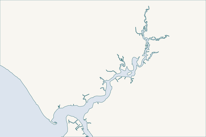
Bon Secour & the Bon Secour River at a glance
- Who permits it
- Baldwin County for the village; the City of Foley only inside its limits
- Call first
- County Building Department, (251) 972-6837, or Foley Planning, (251) 952-4011
- The water
- Bon Secour River, about 8 miles long, with a federal channel 80 feet wide
- Local rule to know
- Keep structures at least 100 feet from the federal channel
Get to know your waterfront
Bon Secour is an unincorporated village on an 8-mile working river. The county permits most work, and Foley covers lots inside its limits. Near the mouth, commercial seafood businesses sit beside homes. Upriver the banks narrow and the water quiets, so access for equipment changes along the river.
TIGERweb Census Current (2026) Census Designated Places layer; Census 2020 layer; 2020 ZCTA-to-place relationship file · Bon Secour River, Oyster Bay, and Skunk Bayou Watershed Management Plan (January 2017) · CRS Flood Insurance Program - Baldwin County Planning & Zoning (Internet Archive copy)
Bon Secour River permits, channel limits and shoreline choices
Who permits a bulkhead or dock on the Bon Secour River?
Baldwin County, for most of the village and river mouth. The Census Bureau carries Bon Secour as a place with no municipal government. Census place record County permit jurisdiction covers unincorporated land. County permit jurisdiction
The river lies below the 10-foot contour, so ADEM's coastal rules apply too. ADEM coastal area rule The river and Boggy Branch are classed for swimming plus fish and wildlife. ADEM water use classification
Unsure which side of a city line you are on? The county parcel viewer shows city limits and permit jurisdictions as map layers. County parcel viewer steps
Where do Foley's city limits begin upriver?
The river rises in Foley and runs south to the bay. MBNEP river description Foley's boundary starts near latitude 30.33, a short way north of the village center. Census place geometry
- Inside the city, new piers, docks, boathouses, retaining walls, wharves and bulkheads need a riparian structure permit. So does a rebuild after damage above 50 percent. Foley riparian permit code
- Foley asks for two feet above base flood elevation on new construction. The county asks for one foot. Foley freeboard rule County freeboard rule
- The city planning office is at (251) 952-4011. Foley Building Department
How does the federal channel limit what you can build?
The Corps keeps an 80-foot channel dredged to 10 feet from just below Beacon 2 up to Day Marker 30. Above that the depth is 6 feet, ending above Day Marker 37. Corps channel listing
Two turning basins sit on the south bank, at miles 1.6 and 2.5. Coast Pilot 5 Keep pilings, mooring posts and boat lifts clear of them.
- State Lands wants structures 100 feet or more from a federal channel. It caps them at 25 percent of the waterway. State Lands width rule
- The Corps' general pier permit has the same 100-foot buffer, though it can be waived. Alabama General Permit 05
- The river spans about 2,000 feet at the mouth. It tightens to 150 feet at the County Road 10 bridge, where a quarter of the width is under 40 feet. River dimensions
The research found no dated notice of recent dredging. Call the Corps regulators at (251) 690-2658 before building near a turning basin. Corps Regulatory contact Some residents blame channel dredging for bay shore erosion, a claim the plan says needs more study. Bon Secour plan comment
Which reach of the river are you on?
The watershed plan's survey divides the river into zones. Plan field survey
| Reach | What the survey found |
|---|---|
County Road 12 to Keller Road | Canoe, kayak and jon boat water; wide buffers |
Keller Road up to County Road 10 | Bigger boats can run; homes on both banks; some riprap and bulkheads |
Lowest reach | Homes lining banks; seafood businesses near the mouth |
Sources: Plan field survey
A 2011 state survey found more than 30 miles of tidal shoreline, most of it natural. Wood and steel bulkheads cover about 5 miles. Shoreline study summary Replacing a wall in a built-up reach is routine. Hardening a natural bank draws questions.
ADEM allows a bulkhead only on three conditions. ADEM bulkhead conditions
- No fill goes into wetlands.
- The wall stands on the dry side of mean high tide and of any wetlands.
- No feasible non-structural option exists.
What does the new County Road 6 launch change?
It gives the river its first public ramp. Baldwin County opened the Launch at CR 6 on April 24, 2025, calling it the first and only public launch on the river. FOX10 report The park at 5587 County Road 6 has two launches, a kayak station, two fishing piers and limited lighted parking. County launch listing
The plan called for 69 truck-and-trailer spaces, so expect boat traffic and room to stage a small barge. The county's public bids, for a large site and not a homeowner quote, give local price points.
- Installed riprap, Class 2 at 18 inches thick, bid at about $88 to $150 per square yard in April 2024. County bid tabulation
- A timber fishing pier bid at about $128 to $207 per square foot. County bid tabulation
What about flooding and elevation?
- Baldwin County names Bon Secour among its repetitive-loss areas, where the same properties flood repeatedly. County CRS page
- The county wants the lowest floor a foot above base flood elevation, backed by an elevation certificate. County freeboard rule
- Unincorporated Baldwin County is a Class 7 community in the FEMA rating system. That gives a 15 percent flood insurance discount in a mapped flood zone. FEMA CRS table
- A standard federal flood policy leaves out seawalls, bulkheads, piers and docks. NFIP policy exclusions
The insurance guide covers what to ask your agent.
Is a living shoreline realistic here?
On the open bay shore, yes. The Nature Conservancy built about one-third mile of offshore breakwaters near Skunk Bayou in 2012. A larger federal project added about 1.6 miles at the Swift Tract. Bon Secour plan That work cost $5,000,080 in settlement funds. NOAA project record
The watershed plan urges living shorelines along the river, Oyster Bay and Skunk Bayou, where bare banks have slowly retreated. Plan recommendation
The river has been listed for mercury since 2006 and the bay for pathogens since 1998. The listings point to septic systems and runoff. 303(d) list summary See the living shorelines guide.
What should you expect from the seafood neighbors?
Bon Secour Fisheries, at 17449 County Road 29 South, has packed shrimp and oysters at its current site since the late 1940s. It runs its own trawlers and trucks. Alabama Seafood Marketing Commission
- Near the mouth, expect commercial wakes, early traffic and truck noise.
- Design a floating dock, lift or wall cap for wake as well as storms.
The river mouth is in the Plash Island guide. The bay shore to the west is in the Fort Morgan bay side guide. Countywide rules are on the Baldwin County page.
What could the work cost?
The only local price points are the public bids in the County Road 6 launch section. Private bulkhead pricing depends on length, water access and the reach. Get a written scope from a licensed contractor.
These are published prices, not a quote. Local numbers come from Baldwin County public bids and Orange Beach permits. National guides fill the gaps and are labeled as national. Your wall depends on height, access, soil and permits.
Compare quotes and plan a budget →Find the relevant permits and records
| Starting point | What to resolve | Prepare and look up |
|---|---|---|
Baldwin County Building Department | Flood permit for bulkheads, seawalls, piers and docks in the village and lower river | Corps and State Lands papers, $75 fee; (251) 972-6837. |
City of Foley Environmental Department | Riparian permit if the parcel is inside Foley limits | Site plan with the application; planning office (251) 952-4011. |
ADEM Coastal Program | Coastal review of walls and piers below the 10-foot contour | |
Corps of Engineers, Mobile District | Federal permit and channel clearance | Distance to Day Markers and turning basins; (251) 690-2658. |
State Lands Division, Coastal Section | Consent of Use for anything below the high tide line | $100 request form; keep 100 feet from the channel; (251) 621-1216. |
Four steps for a Bon Secour river lot
Settle the office first, then the channel, then the design.
Check the city line
Use the county parcel viewer layers for city limits and permit jurisdictions.
Pull past permits
Search the county portal for earlier permits and elevation certificates on your address.
Measure to the channel
Ask a surveyor to show your distance to the channel, markers and turning basins.
USACE National Channel Framework, ChannelReach layer (Mobile District, CESAM), channel areas CESAM_BS_01_BSR and CESAM_BS_02_SFC · United States Coast Pilot 5, Chapter 7 (Mobile Bay; pages dated 25 Oct 2026)
Ask about elevation
Get the flood zone and the one-foot freeboard rule in writing before drawing a deck or cap height.
Floodplain Management / Flood Zone Information - Baldwin County Building Department · CRS Flood Insurance Program - Baldwin County Planning & Zoning (Internet Archive copy)
Plan a Bon Secour river project
Tell us the road or creek, the shoreline length and what you have now. We can help sort out the permit office and channel limits, and a local marine contractor can call.
Built on Gulf Shores and Baldwin County permit rules, Alabama coastal law, public bids and storm records.
Bon Secour & the Bon Secour River project questions
Is there a public boat ramp on the Bon Secour River?
Yes. Baldwin County opened the Launch at CR 6 on April 24, 2025, at 5587 County Road 6. It has two launches, a kayak station and two fishing piers, with no launch fee.
The Launch at CR 6 opening up new waters to Baldwin County boaters · County Road 6 - Baldwin County Boat Launches
Does Foley's riparian permit apply to my river lot?
Only if the parcel is inside Foley city limits. Check the county parcel viewer first.
City of Foley Code Ch. 4, Art. VIII Shoreline Construction Activities (Secs. 4-221 to 4-232), Ord. No. 1024-08 · Permitting FAQs | Baldwin County Building Department
How close can a pier be to the federal channel?
The state wants a 100-foot gap. The Corps' pier permit uses the same gap, though it can be waived.
ADCNR Admin. Code r. 220-4-.09 Placement and Configuration of Piers and Other Improvements on State Owned Submerged Lands · ALGP-05 Piers and Pile-Supported Structures (SAM-2025-00970-LHL), 2026 Alabama General Permit Program
Why does Bon Secour have flood rules for rebuilds?
The county lists Bon Secour among its repetitive-loss areas. The lowest floor must sit one foot above base flood elevation, so a rebuild may need elevation work.
CRS Flood Insurance Program - Baldwin County Planning & Zoning (Internet Archive copy) · Floodplain Management / Flood Zone Information - Baldwin County Building Department
Are living shorelines used near Bon Secour?
Yes, on the open bay shore. Breakwaters from 2012 and the 1.6-mile Swift Tract project protect marsh west of the river. The watershed plan also recommends them along the river.
Bon Secour River, Oyster Bay, and Skunk Bayou Watershed Management Plan (January 2017)
Keep planning
Nearby waterfront guides
Plash Island & the Oyster Bay shore, Fort Morgan bay side & Navy Cove, Weeks Bay, Fish River & Marlow
Show sourcesHide sources
- TIGERweb Census Current (2026) Census Designated Places layer; Census 2020 layer; 2020 ZCTA-to-place relationship fileSource reviewed 2026-10-31
- Bon Secour River, Oyster Bay, and Skunk Bayou Watershed Management Plan (January 2017)Source reviewed 2026-10-31
- CRS Flood Insurance Program - Baldwin County Planning & Zoning (Internet Archive copy)Source reviewed 2026-11-05
- Permitting FAQs | Baldwin County Building DepartmentSource reviewed 2026-10-31
- Ala. Admin. Code ch. 335-8-1 Coastal Area Management Program (definitions and permissible uses)Source reviewed 2026-11-01
- Ala. Admin. Code r. 335-6-11-.02, Use Classifications (ADEM Water Division; amendment adopted 2025-04-11, filed 2025-04-15, effective 2025-06-14)Source reviewed 2026-11-01
- TIGERweb Places layer - Foley city, AlabamaSource reviewed 2026-11-01
- City of Foley Code Ch. 4, Art. VIII Shoreline Construction Activities (Secs. 4-221 to 4-232), Ord. No. 1024-08Source reviewed 2026-10-31
- Ordinance 24-2006-ORD Floodplain Development OrdinanceSource reviewed 2026-11-01
- Floodplain Management / Flood Zone Information - Baldwin County Building DepartmentSource reviewed 2026-11-01
- Building Department | City of FoleySource reviewed 2026-10-31
- USACE National Channel Framework, ChannelReach layer (Mobile District, CESAM), channel areas CESAM_BS_01_BSR and CESAM_BS_02_SFCSource reviewed 2026-10-31
- United States Coast Pilot 5, Chapter 7 (Mobile Bay; pages dated 25 Oct 2026)Source reviewed 2026-10-31
- ADCNR Admin. Code r. 220-4-.09 Placement and Configuration of Piers and Other Improvements on State Owned Submerged LandsSource reviewed 2026-10-31
- ALGP-05 Piers and Pile-Supported Structures (SAM-2025-00970-LHL), 2026 Alabama General Permit ProgramSource reviewed 2026-10-31
- South Atlantic Division > Missions > Regulatory > AlabamaSource reviewed 2026-10-31
- ADEM Admin. Code r. 335-8-2-.06 Shoreline Stabilization and Erosion MitigationSource reviewed 2026-10-31
- The Launch at CR 6 opening up new waters to Baldwin County boatersSource reviewed 2026-11-01
- County Road 6 - Baldwin County Boat LaunchesSource reviewed 2026-11-05
- The Launch at CR 6 - Bid Tabulation (HW21103000)Source reviewed 2026-10-31
- CRS Eligible Communities, October 1, 2026Source reviewed 2026-11-01
- 44 CFR Part 61, Appendix A(1), Standard Flood Insurance Policy, Dwelling FormSource reviewed 2026-10-31
- DWH - AL Swift Tract Living Shoreline (Restoration Center project record)Source reviewed 2026-10-31
- Processor of the Month: Chris Nelson of Bon Secour FisheriesSource reviewed 2026-11-01
- Permit Application Checklists | Baldwin County Building DepartmentSource reviewed 2026-10-31
- Baldwin County Building Inspection Department Fee Schedule (effective 10/01/2023, updated 10/01/2024)Source reviewed 2026-10-31
- Contact Us | Baldwin County Building DepartmentSource reviewed 2026-10-31
- Environmental | City of FoleySource reviewed 2026-10-31
- Alabama Coastal Area Management Program (ADEM Coastal Program page)Source reviewed 2026-10-31
- Contact Us (Alabama Department of Conservation and Natural Resources)Source reviewed 2026-10-31
- Search Permits, Reports, Certificates of Occupancy, & Elevation Certificates | Baldwin County Building DepartmentSource reviewed 2026-10-31