Intracoastal Waterway bulkheads and docks in Gulf Shores
An Intracoastal Waterway bulkhead in Gulf Shores starts with one line on your survey: the Corps right-of-way. Zoning overlays, Canal Park and the Oyster Bay shore come next.
Describe your project on this page ↓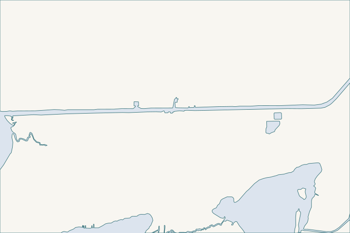
Waterway Village & the Intracoastal at a glance
- Who permits it
- City inside limits, Baldwin County outside, plus Corps and State Lands
- Call first
- City of Gulf Shores Building Department, (251) 968-1150
- The water
- Intracoastal Waterway, kept at 12 ft deep and 150 ft wide
- Local rule to know
- Rear yards at the Corps right-of-way line can drop to 15 ft
Get to know your waterfront
The waterway runs east to west through Gulf Shores, crossed by the Highway 59 bridge, which the zoning code calls the W. C. Holmes Bridge. The south bank holds Canal Drive, W Canal Drive and E 24th and 25th Avenues. Inside city limits the city issues building permits. Parts of the Oyster Bay shore farther west are outside the city, and the county takes over there.
Zoning Ordinance for the City of Gulf Shores (September 14, 2026, as amended by Ordinance No. 2228) · Canal Park · TIGERweb Places, County Subdivisions, Consolidated Cities (layer 4) · TIGERweb Census Current (2026) Legal and Statistical Entities, Incorporated Places layer (January 1, 2026 vintage), point-in-polygon queries
The Corps line, the zoning layers and the shore west of the bridge
Who controls the edge of the waterway?
- The Corps controls the channel and a strip of land along it.
- The city controls zoning and building behind that strip.
- State Lands controls the bottom.
The Corps lists the federal channel at 12 feet authorized depth and 150 feet wide. That covers the Alabama reaches named Bon Secour Channel, Foley Land Cut and Wolf Bay Channel. Corps channel framework
Many lots end at a Corps right-of-way line, or at a Corps easement on the south bank. Anything built inside that easement, including a city-required walking path, needs Corps approval. Zoning Ordinance Secs. 6-3G(4), 9-2
State Lands adds a distance rule. A structure on state submerged land must stay 100 feet from a federal navigation channel. It is also capped at one quarter of the water's width at that spot. ADCNR rule 220-4-.09(4)(d)
Ask one question first: where is the Corps line on your survey? A wall, a ladder or a pathway on the wrong side of it becomes a federal matter.
What do the ICW districts and the Waterway Village Overlay change?
The zoning code splits the waterway into a north-bank district (ICW-N) and a south-bank district (ICW-S). It limits north-bank heights and setbacks to protect south-bank homes. Zoning Ordinance Sec. 9-2
| Item | Rule |
|---|---|
Rear yard at Corps right-of-way line | 15 feet, with 30 percent building coverage |
ICW-S single-family or duplex | Rear yard of 10 feet along the canal easement |
Pathway in the Corps easement | At least 12 feet wide on new developments |
Boat docks and wharves in the overlay | Conditional use permit |
Marina (10 or more slips) | Conditional use, 1 acre, 200 feet of frontage |
Conditional use permit | $300 plus ads, about 90 days |
Sources: Zoning Ordinance Secs. 6-3G(4), 9-2 Zoning Ordinance Sec. 9-2D Zoning Ordinance Sec. 10-10 Zoning Ordinance Sec. 11-8 City Planning and Zoning page
The Waterway Village Overlay (WV-O) covers two neighborhood centers on the waterway. It protects "working waterfront" uses such as docks, lifts, ramps, boat repair, seafood markets and public access. Public water access is allowed by right. Zoning Ordinance Sec. 10-10
- Marinas may not fuel or launch within 50 feet of a residential line. They may not store fuel or place a pump-out tank over water. Every state and federal approval must be in hand at application. Zoning Ordinance Sec. 11-8
- New shared access from a multifamily building may not run through an R-1 or R-2 district. Zoning Ordinance Sec. 6-9
What is happening at Canal Park, the bridge and the roads?
Canal Park, at 50 West Canal Drive, sits under the Highway 59 bridge. It has a boat launch, parking, restrooms and a courtesy dock, open dawn to dusk. City Canal Park page
The launch nearly closed in August 2026 over strong currents, barge traffic and trailer conflicts. On August 26, 2026 the council agreed to renew the ALDOT agreement, so it stays open. FOX10, Aug 2026
- Pedestrian bridge: a new pedestrian and bicycle bridge is going in across the waterway, with plazas at both landings. A $3.6 million GOMESA grant covers the full $3,606,465 cost. The city estimated 12 to 14 months in February 2026. City update, Feb 2026
- Roads: a 2020 memo describes a roughly $54 million program. It reroutes Canal Road East on the south side and extends Waterway East Boulevard on the north. City memo, Feb 2020
How do wakes, currents and channel depth affect a wall?
A wall on a federal channel faces boat wakes, propeller wash and moving water all day, not only storms. Canal Park's currents and barge traffic show it. No measured wake data turned up.
- The waterway drains Wolf Bay, and its flow can turn toward Perdido Bay or Mobile Bay as winds and tides shift. Wolf Bay plan
- Two fixed bridges cross the cut. The Highway 59 span clears 125 feet wide and 73 feet high. The Foley Beach Express span is 250 feet wide and 73 feet high. Coast Pilot 5
Design the toe of the wall for scour and wash, not only surge. See riprap and shoreline stabilization and seawall replacement. Commercial owners should also read marina bulkhead repair.
Who permits the Oyster Bay edge west of the bridge?
West of the bridge the waterway runs through city land, county land and marsh. Lots on the south bank near Bear Creek and Sand Bayou are inside the city. Oyster Bay itself tests as outside it. Census place layer, 2026 Census boundary check
The city surrounds much of the area, so two neighbors can have different permit offices. Inside city limits, use the city. Outside them, use Baldwin County. County building page
- County path: a bulkhead or pier is a Flood Permit, sub-type Marine Accessory, in the CitizenServe portal. Corps approval and a State Lands notice come first. County marine permit page
- County fees: $75 flood permit in a mapped flood area, plus 1.5 percent of job value and two small add-ons ($15 and $10). County fee schedule
- Protected land: a $12,511,400 federal grant protects about 836 acres of tidal marsh, maritime forest and swamp inside the city, beside a Bon Secour refuge unit. NFWF award
- Disputed cause: some residents blame Corps maintenance dredging for erosion near Bon Secour Bay. The watershed plan says that claim needs more study. Bon Secour watershed plan
A 2022 archaeology study also confirmed an old canoe route, dated to about A.D. 600, that joined Oyster Bay to Little Lagoon. Digging near it could raise cultural-resource questions. Journal of Field Archaeology, 2022
Shoreline and boat-access facts for the bay are in the Plash Island guide.
Which offices and guides come next?
- Dock and lift jobs: docks and boat lifts and the permit overview.
- Larger frontage or shared owners: condo seawall repair and HOA seawall repair.
- Neighbors: the old-town canals to the south and Bon Secour along the river.
Several lots on one canal can plan together; see the neighbor project guide.
What could the work cost?
Waterway frontage often means engineered or commercial work. Angi lists $250 to $700 per foot for steel and $200 to $800 for concrete, so 100 feet runs about $25,000 to $80,000 before permits. The Corps fee is $100 for commercial work and $10 for personal use. ADEM charges $800 for a single-family pier and $2,400 for other piers.
These are published prices, not a quote. Local numbers come from Baldwin County public bids and Orange Beach permits. National guides fill the gaps and are labeled as national. Your wall depends on height, access, soil and permits.
Compare quotes and plan a budget →Find the relevant permits and records
| Starting point | What to resolve | Prepare and look up |
|---|---|---|
City of Gulf Shores Building Department | Building permit inside city limits | Call (251) 968-1150. Bring Corps and State Lands approvals first, as the city requires them for structures at the water. |
City Planning and Zoning | Overlay review, setbacks and conditional use permits | Call (251) 968-1150 to book a conditional use appointment. Expect $300 plus ads, and about 90 days. |
U.S. Army Corps of Engineers, Mobile District | Channel, right-of-way and easement approvals | Call (251) 690-2658. Bring a survey with the Corps line marked, and use the Corps online portal. |
Alabama State Lands Division, Coastal Section | State submerged land consent | Call (251) 621-1216. Keep structures 100 feet off the federal channel and within a quarter of the water width. |
ADEM Coastal Program | Coastal area permit for armor or piers | Call (251) 304-1176. Piers need pilings that let tidal water flow, and cannot cover wetlands or grassbeds. |
Baldwin County Building Department | Marine Accessory flood permit outside city limits | Call (251) 972-6837. File online in CitizenServe, attaching your Corps approval and the State Lands notice of intent. |
How to find the line, the district and the office for your lot
Four checks before any design work.
Find the Corps line on your survey
Ask your surveyor to mark the Corps right-of-way line or easement. Rear yards and path rules key off it.
Zoning Ordinance for the City of Gulf Shores (September 14, 2026, as amended by Ordinance No. 2228)
Confirm your zoning district
Ask city Planning and Zoning whether the lot is in ICW-N, ICW-S or the Waterway Village Overlay.
Zoning Ordinance for the City of Gulf Shores (September 14, 2026, as amended by Ordinance No. 2228)
Confirm city or county
West of the bridge, check the parcel against the city boundary. City lots use the city; others use Baldwin County.
Permitting FAQs | Baldwin County Building Department · TIGERweb Census Current (2026) Legal and Statistical Entities, Incorporated Places layer (January 1, 2026 vintage), point-in-polygon queries
Search past permits
Newer county permits (November 2020 onward) live in the CitizenServe portal. Earlier ones sit on a separate Building Permits Link page.
Working on Intracoastal frontage?
Share the address, the length of wall and any dock or lift plans. We can help you sort the Corps line from the city rules, and a local marine contractor can come back with a design.
Built on Gulf Shores and Baldwin County permit rules, Alabama coastal law, public bids and storm records.
Waterway Village & the Intracoastal project questions
Does the Corps own the back of my waterway lot?
On some lots the line is a Corps right-of-way line, and on the south bank it can be a Corps easement. Work inside the easement needs Corps approval. Your survey shows which applies.
Zoning Ordinance for the City of Gulf Shores (September 14, 2026, as amended by Ordinance No. 2228)
Can I build a dock in the Waterway Village Overlay?
Boat docks and wharves there need a conditional use permit. It costs $300 plus advertising and takes about 90 days, including Planning Commission and Council hearings.
Zoning Ordinance for the City of Gulf Shores (September 14, 2026, as amended by Ordinance No. 2228) · Planning and Zoning Permits and Applications
Is the Canal Park boat launch staying open?
Yes, for now. The council agreed on August 26, 2026 to renew the ALDOT agreement after the city weighed closing the launch over currents, barge traffic and trailer conflicts.
Gulf Shores renews agreement for Canal Park boat launch (and Aug. 20, 2026 report)
How deep is the Intracoastal Waterway here?
The Corps lists the Alabama reaches at 12 feet authorized and maintained depth and 150 feet wide. Lot-side depth near a wall can differ, so survey it.
Who permits a wall on the Oyster Bay shore?
The city does inside its limits, and Baldwin County does outside them. Oyster Bay itself tests outside the city, so check each parcel. Corps and State Lands apply either way.
TIGERweb Census Current (2026) Legal and Statistical Entities, Incorporated Places layer (January 1, 2026 vintage), point-in-polygon queries · Permitting FAQs | Baldwin County Building Department · Permit Application Checklists | Baldwin County Building Department
What is being built across the waterway?
A pedestrian and bicycle bridge with plazas at both landings. A $3.6 million GOMESA grant covers the $3,606,465 construction cost.
Waterway Village Pedestrian Plazas Work Progressing - Paid for by GOMESA Grant Funding
Keep planning
Nearby waterfront guides
Stanton Creek & the old-town canals, Plash Island & the Oyster Bay shore, Bon Secour & the Bon Secour River
Show sourcesHide sources
Price and technical sources
- Angi. How Much Does It Cost to Build a Seawall? [2026 Data]. United States (national consumer guide). Source reviewed 2026-11-01
- Zoning Ordinance for the City of Gulf Shores (September 14, 2026, as amended by Ordinance No. 2228)Source reviewed 2026-11-01
- Canal ParkSource reviewed 2026-10-31
- TIGERweb Places, County Subdivisions, Consolidated Cities (layer 4)Source reviewed 2026-11-01
- TIGERweb Census Current (2026) Legal and Statistical Entities, Incorporated Places layer (January 1, 2026 vintage), point-in-polygon queriesSource reviewed 2026-10-31
- USACE National Channel Framework, ChannelReach layer (Mobile District, CESAM), channel areas CESAM_GA_03_BSC, CESAM_GA_04_FLC, CESAM_GA_05_WBC and CESAM_GF_01_PERSource reviewed 2026-10-31
- ADCNR Admin. Code r. 220-4-.09 Placement and Configuration of Piers and Other Improvements on State Owned Submerged LandsSource reviewed 2026-10-31
- Planning and Zoning Permits and ApplicationsSource reviewed 2026-11-01
- Gulf Shores renews agreement for Canal Park boat launch (and Aug. 20, 2026 report)Source reviewed 2026-11-01
- Waterway Village Pedestrian Plazas Work Progressing - Paid for by GOMESA Grant FundingSource reviewed 2026-10-31
- Council memo: BUILD Restore Program (Feb. 3, 2020)Source reviewed 2026-11-01
- Wolf Bay Watershed Management Plan (Volkert, Inc. and Allen Engineering and Science for the Mobile Bay National Estuary Program)Source reviewed 2026-10-31
- United States Coast Pilot 5, Chapter 12 (Intracoastal Waterway; pages dated 25 Oct 2026)Source reviewed 2026-10-31
- Permitting FAQs | Baldwin County Building DepartmentSource reviewed 2026-10-31
- Permit Application Checklists | Baldwin County Building DepartmentSource reviewed 2026-10-31
- Baldwin County Building Inspection Department Fee Schedule (effective 10/01/2023, updated 10/01/2024)Source reviewed 2026-11-05
- Bon Secour-Oyster Bay Wetland Acquisition (Alabama at a Glance)Source reviewed 2026-10-31
- Bon Secour River, Oyster Bay, and Skunk Bayou Watershed Management Plan, Section 6 (critical issues)Source reviewed 2026-10-31
- History and Hydrology: Engineering Canoe Canals in the Estuaries of the Gulf of Mexico (Waselkov et al., Journal of Field Archaeology, 2022)Source reviewed 2026-10-31
- Building Permits | Gulf Shores, ALSource reviewed 2026-11-01
- FAQs - Building Department | Gulf Shores, ALSource reviewed 2026-11-01
- Building Department Building Permitting Procedures Handbook (2025) and Building FAQ (https://gulfshoresal.gov/m/faq?cat=21)Source reviewed 2026-11-01
- South Atlantic Division > Missions > Regulatory > AlabamaSource reviewed 2026-10-31
- 33 CFR 325.1 Applications for permits, paragraph (f) FeesSource reviewed 2026-10-31
- Contact Us (Alabama Department of Conservation and Natural Resources)Source reviewed 2026-10-31
- Alabama Coastal Area Management Program (ADEM Coastal Program page)Source reviewed 2026-10-31
- ADEM Admin. Code Chapter 335-8-2, rule 335-8-2-.05 Piers, Docks, Boathouses, and Other Pile Supported StructuresSource reviewed 2026-10-31
- ADEM Admin. Code Chapter 335-1-6 Application Fees, adopted rule effective October 15, 2026Source reviewed 2026-10-31
- Contact Us | Baldwin County Building DepartmentSource reviewed 2026-10-31
- Building Department - Search Permits & ReportsSource reviewed 2026-10-31
- Ala. Admin. Code r. 335-6-11-.02, Use Classifications (ADEM Water Division; amendment adopted 2025-04-11, filed 2025-04-15, effective 2025-06-14)Source reviewed 2026-11-01