Little Lagoon North Shore Bulkhead and Shoreline Guide
A Little Lagoon bulkhead on the north shore needs Corps and State Lands approval before a city permit. Next door, the city is testing a living shoreline at Mo's Landing, where its own park wall is failing.
Describe your project on this page ↓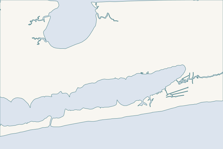
Little Lagoon north shore & Mo's Landing at a glance
- Who permits it
- Corps and State Lands first, then the city
- Call first
- City Building Department, (251) 968-1150
- The water
- Little Lagoon, rated for shellfish, swimming and fish
- Local rule to know
- No clay fill; septic reimbursement ends November 30, 2026
Get to know your waterfront
The north shore is the Fort Morgan Road (State Route 180) side of Little Lagoon, inside Gulf Shores at Mo's Landing. No river feeds the lagoon, and sources put its length at 6 to 10 miles. ADEM classes all of it for shellfish harvesting, swimming, and fish and wildlife. Permits come from the Corps, State Lands and the city, in that order.
TIGERweb Places, County Subdivisions, Consolidated Cities (layer 4) · Groundwater Discharge, Benthic Coupling and Microalgal Community Structure in a Shallow Coastal Lagoon (LittleLagoonGroundwater) · Ala. Admin. Code r. 335-6-11-.02, Use Classifications (ADEM Water Division; amendment adopted 2025-04-11, filed 2025-04-15, effective 2025-06-14) · FAQs - Building Department | Gulf Shores, AL · United States Coast Pilot 5, Chapter 6 (Apalachicola Bay to Mobile Bay area; pages dated 25 Oct 2026)
Shoreline choices on the north shore of Little Lagoon
North shore owners can repair or replace a bulkhead, or build a living shoreline. The permit order is fixed. The south side has a different rule set, in the south shore guide.
Where does the city end on the north shore?
Most of it is in the city. The Census place layer puts Mo's Landing, Long Bayou and Sand Bayou inside, and Childress Point and Seymour Bluff outside. Census place layer
Long Bayou and Sand Bayou are small tidal guts a little north of the western lagoon. USGS place names The zoning code does not count a bayou as frontage on a major water body, so ask the city which rule applies to a lot on a gut. Zoning, Art. 4
Check your parcel first. Near the west edge, lots can fall in the county. Confirm the office before you pay for drawings.
What is happening to the bulkhead at Mo's Landing?
The city's own park wall is failing. Mo's Landing, at 18068 Fort Morgan Road, has a boat launch, restrooms and picnic areas. About 100 feet of old wooden bulkhead is failing in several places, and another 90 feet has no protection and erodes noticeably each year. City RFQ 2023-0307
The park sits 1.8 miles west of Highway 59, with two concrete ramps and room for about 25 vehicles. MBNEP launch list
The city plans a living shoreline demonstration here as a model for private owners. Its request lists these design options:
- native plantings and marsh creation
- coir logs (rolled coconut fiber) and marsh sills
- timber, headland or offshore breakwaters
- graded sand fill, with a boardwalk and signs
Source: City RFQ 2023-0307
Could a living shoreline replace my bulkhead?
Often, on a calm lagoon lot. Under the Joe Faust Living Shoreline Act, State Lands may let a residential owner dredge riparian sand for one at half the usual dredge fee. The law aims to encourage living shorelines over vertical walls. Act 2024-294
Fill placed below mean high tide for a living shoreline is not reclamation and does not change title to state submerged lands. State Lands rule
Federal Nationwide Permit 54 is the Corps permit for a living shoreline where waves are gentle to moderate. 2026 NWP 54
- It must include living habitat, such as fringe marsh or an oyster reef.
- Work may reach no more than 30 feet beyond mean low water and cover no more than 500 feet of bank, unless the Corps waives either limit.
- Each new project starts with a notice to the Corps before work.
The living shoreline guide compares costs and lifespans. For hard armor, see riprap and shoreline stabilization.
How much of the lagoon is already hardened?
More than half. A U.S. Fish and Wildlife Service funding notice estimates over 50 percent of the shoreline is hardened, and two-thirds of the rest lies inside the Bon Secour refuge. It says bulkheads and piers have hurt living shoreline here. USFWS notice
A 2011 mapping put hard armoring at 31.7 percent. Armoring table The two numbers use different methods and dates.
What do RESTORE money and the septic-to-sewer program offer?
The lagoon has a funded cleanup. In 2022 the council approved a RESTORE grant of up to $5,905,356, fully reimbursable. Goals include about 1,000 feet of living shorelines, canal fixes and about 200 septic connections. Council memo
The septic program repays actual reasonable costs, up to $5,000 each, with city approval in advance. You must be inside city limits and the lagoon watershed (USGS HUC 031401070205), with a working septic system and a Gulf Shores Utilities sewer line nearby. City RFQ
| Item | Detail |
|---|---|
Reimbursement cap | $5,000 per owner |
Reimbursement budget | $1,300,000 |
Participants expected | About 200 over three years |
Project end date | November 30, 2026 |
Sources: City RFQ MBNEP summary
The end date is close, so call the city to ask whether money remains. Researchers link the lagoon's toxic Pseudo-nitzschia blooms to groundwater, so septic leakage is the concern. NSF study
What is the permit path for a lagoon-side bulkhead or pier?
For a new bulkhead, wharf or pier, the city holds its building permit until the Corps and State Lands sign off. Some changes to an existing structure can move faster under national general permits, case by case. City handbook City handbook
- ADEM's coastal fee is $1,000 for a short bulkhead or riprap run, up to 50 feet. Longer runs pay $1,665. ADEM fee schedule
- The city bulkhead permit is a flat $50. Piers cost $4 per $1,000 of value. City fee schedule
- A replacement face may sit up to two feet seaward of the average high-tide line. A first-time wall belongs on that line or inland. State Lands rule
- Clay or sand-clay backfill is banned citywide, unless it sits inside an enclosed foundation. City code 7-21
- Lot stormwater may reach the lagoon only with no pollution, undermining or silting, and no more than a 0.0-foot rise in the ten-year storm. City code 7-108
See the permit overview and the replacement service page.
What flood rules apply between Fort Morgan Road and the lagoon?
Lots south of Fort Morgan Road carry stricter rules. A home's lowest floor must be a foot or more over base flood elevation. City flood ordinance FEMA maps effective in 2017 raised base flood elevations by about three feet in several areas south of the road, and more at some lagoon-front lots. City staff memo
In a flood zone there, an enclosure below the lowest floor is capped at 300 square feet, and one accessory structure up to 400 square feet is allowed. City code 7-30 Read the flood zone guide before designing a boathouse or shed.
What could the work cost?
On the north shore the fixed costs are small and the wall is the big item. ADEM bills $1,000 for a short run and $1,665 past 50 feet, and the city bulkhead permit is $50. A living shoreline can use State Lands dredge fees at half rate. Get a priced plan, then compare timber against a marsh sill.
These are published prices, not a quote. Local numbers come from Baldwin County public bids and Orange Beach permits. National guides fill the gaps and are labeled as national. Your wall depends on height, access, soil and permits.
Compare quotes and plan a budget →Find the relevant permits and records
| Starting point | What to resolve | Prepare and look up |
|---|---|---|
U.S. Army Corps of Engineers, Mobile District | Federal permit for a new bulkhead, pier or living shoreline | Drawings that show mean high water, plus a pre-construction notice for a living shoreline. Call (251) 690-2658. |
Alabama State Lands Division, Spanish Fort | Approval to work at or waterward of mean high tide | Proof of upland ownership and a survey. Call (251) 621-1216. |
ADEM Coastal Program | Coastal review of shoreline stabilization on the lagoon | Fee of $1,000 or $1,665 depending on length. Call (251) 304-1176. |
City of Gulf Shores Building Department | Building permit after the Corps and State Lands sign off | Pier/Bulkhead application and a clean-sand backfill plan. Call (251) 968-1150. |
City RESTORE septic program | Reimbursement for converting a septic system to sewer | Written approval before work starts; keep receipts. City Hall: (251) 968-2425. |
Records worth pulling for a lagoon-side lot
Four checks keep a north shore project on track.
Confirm the city boundary
Ask the city whether your parcel is inside the limits. The Census layer puts Mo's Landing inside and Childress Point outside.
TIGERweb Places, County Subdivisions, Consolidated Cities (layer 4)
Read the Mo's Landing design options
The city request lists the shoreline types being tested. Use it to frame questions for your contractor.
RFQ 2023-0307 Engineering and Program Management Services, Little Lagoon Restoration Project
Ask about septic reimbursement
If you are on septic, ask the city whether the RESTORE reimbursement is still open before the November 30, 2026 end date.
RFQ 2023-0307 Engineering and Program Management Services, Little Lagoon Restoration Project
Find your flood zone
The city can issue a flood zone determination, or you can read FEMA's map service yourself.
Send your north shore request
Tell us your road, how much shoreline you have and whether the wall is timber, vinyl or something else. A local marine contractor will call to walk through timber, vinyl and marsh options.
Built on Gulf Shores and Baldwin County permit rules, Alabama coastal law, public bids and storm records.
Little Lagoon north shore & Mo's Landing project questions
Is a living shoreline allowed on Little Lagoon?
Yes. Alabama law favors living shorelines over vertical walls, and a federal permit covers them on calm shores. The city is building a demonstration at Mo's Landing.
Code of Alabama 1975 Sec. 9-7-13.1, Dredging of Material for Use in Constructing a Residential Living Shoreline · 2026 Nationwide Permit 54, Living Shorelines, 91 FR 768 · RFQ 2023-0307 Engineering and Program Management Services, Little Lagoon Restoration Project
Who approves a new bulkhead on the lagoon?
The Corps of Engineers and State Lands approve first. The city then issues its building permit, and ADEM reviews the coastal side.
City of Gulf Shores Building Department, Building Permitting Procedures Handbook (2025) · ADEM Admin. Code Chapter 335-1-6 Application Fees, adopted rule effective October 15, 2026
Can the city help pay to leave my septic tank?
Possibly. Owners inside city limits and the lagoon watershed can be reimbursed up to $5,000 if the city approves the work first. The program ends November 30, 2026.
RFQ 2023-0307 Engineering and Program Management Services, Little Lagoon Restoration Project
How far out may a replacement wall go?
No more than two feet out from the high-tide line. A wall with no predecessor must sit on that line or behind it.
Can I use red clay to backfill my bulkhead?
No. The city bans clay and sand-clay fill, with an exception for fill inside an enclosed foundation. Use clean sand.
Gulf Shores Code Ch. 7, Art. I In General (city Building Permit Fees page, Municode text)
Keep planning
Nearby waterfront guides
Little Lagoon south shore & west end, Little Lagoon Pass & the Callaway Bridge, Stanton Creek & the old-town canals
Show sourcesHide sources
- TIGERweb Places, County Subdivisions, Consolidated Cities (layer 4)Source reviewed 2026-11-01
- Groundwater Discharge, Benthic Coupling and Microalgal Community Structure in a Shallow Coastal Lagoon (LittleLagoonGroundwater)Source reviewed 2026-10-31
- Ala. Admin. Code r. 335-6-11-.02, Use Classifications (ADEM Water Division; amendment adopted 2025-04-11, filed 2025-04-15, effective 2025-06-14)Source reviewed 2026-11-01
- FAQs - Building Department | Gulf Shores, ALSource reviewed 2026-11-01
- United States Coast Pilot 5, Chapter 6 (Apalachicola Bay to Mobile Bay area; pages dated 25 Oct 2026)Source reviewed 2026-10-31
- USGS National Map Gazetteer (GNIS) geographic names serviceSource reviewed 2026-11-01
- Zoning Ordinance for the City of Gulf Shores (September 14, 2026, as amended by Ordinance No. 2228)Source reviewed 2026-11-01
- RFQ 2023-0307 Engineering and Program Management Services, Little Lagoon Restoration ProjectSource reviewed 2026-11-01
- Gulf Frontal Watershed Management Plan, Tables 3.13 and 4.x, Section 4.9Source reviewed 2026-10-31
- Code of Alabama 1975 Sec. 9-7-13.1, Dredging of Material for Use in Constructing a Residential Living ShorelineSource reviewed 2026-10-31
- ADCNR Admin. Code r. 220-4-.09 Placement and Configuration of Piers and Other Improvements on State Owned Submerged LandsSource reviewed 2026-10-31
- 2026 Nationwide Permit 54, Living Shorelines, 91 FR 768Source reviewed 2026-10-31
- F19AS00267 NOFO Little Lagoon Living ShorelineSource reviewed 2026-11-01
- Coastal Alabama Living Shorelines Policies, Rules, and Model Ordinance Manual (Boyd and Pace; supported by the Mobile Bay National Estuary Program)Source reviewed 2026-10-31
- Council memo: Little Lagoon Restoration Project Grant Sub-Recipient Award Acceptance (June 6, 2022)Source reviewed 2026-11-01
- Request for Qualifications RFQ 2023-0307, Little Lagoon Restoration ProjectSource reviewed 2026-10-31
- City of Gulf Shores Building Department, Building Permitting Procedures Handbook (2025)Source reviewed 2026-11-01
- ADEM Admin. Code Chapter 335-1-6 Application Fees, adopted rule effective October 15, 2026Source reviewed 2026-10-31
- Gulf Shores Code of Ordinances Sec. 7-4 Building permit fees (Municode)Source reviewed 2026-11-01
- Art. V Erosion and Sedimentation Control, Sec. 7-108(b)Source reviewed 2026-11-01
- Gulf Shores Code of Ordinances Ch. 7, Art. IV Flood Damage Prevention (Municode)Source reviewed 2026-11-01
- Council memo: Freeboard Requirements FEMA Flood Maps (Aug. 16, 2017)Source reviewed 2026-11-01
- Art. II Supplemental Requirements, Sec. 7-30(3)Source reviewed 2026-11-01
- South Atlantic Division > Missions > Regulatory > AlabamaSource reviewed 2026-10-31
- ADEM Form 166, Joint Application and Notification (rev. 8/19)Source reviewed 2026-10-31
- Contact Us (Alabama Department of Conservation and Natural Resources)Source reviewed 2026-10-31
- Alabama Coastal Area Management Program (ADEM Coastal Program page)Source reviewed 2026-10-31
- Building Permits | Gulf Shores, ALSource reviewed 2026-11-01
- Little Lagoon Pass ParkSource reviewed 2026-10-31