Plash Island dock permit: which office permits a dock or wall?
No public record says whether the city or Baldwin County permits a Plash Island dock or wall. Plash Island is in Gulf Shores police jurisdiction, not city limits, so get both offices to answer in writing.
Describe your project on this page ↓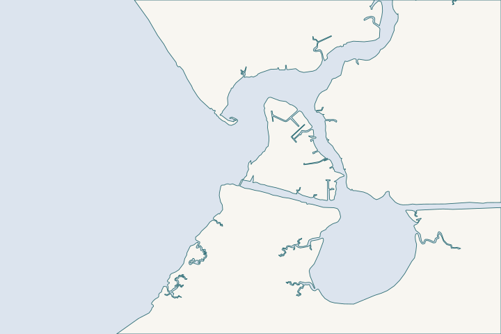
Plash Island & the Oyster Bay shore at a glance
- Who permits it
- Unconfirmed: the city or Baldwin County, plus Corps and State Lands
- Call first
- City Building Department, (251) 968-1150, then the county, (251) 972-6837
- The water
- Bon Secour River mouth, Bon Secour Bay and Oyster Bay
- Local rule to know
- Waterfront setback of 50 ft, or 25 ft with engineered filtration
Get to know your waterfront
Plash Island and the lower Bon Secour River shore sit north and west of the Intracoastal Waterway. The city lists the Plash Island Area as police jurisdiction. The city zoning code still has a Plash Island and Bon Secour River Overlay with a 50-foot waterfront setback. No record we found names the office that issues a pier or bulkhead permit here.
Annexation · Zoning Ordinance for the City of Gulf Shores (September 14, 2026, as amended by Ordinance No. 2228) · Gulf Shores Code Ch. 7 Arts. I, V, VI, VII and Zoning Ordinance Art. 4
Jurisdiction, the overlay and what the water allows
Is Plash Island inside Gulf Shores?
No. It is in the city's police jurisdiction, which is not the same as the city limits. The city annexation page lists the "Plash Island Area" under properties in police jurisdiction. City annexation page
- The Census Bureau's 2026 boundary layer agrees. Flash Point, Bon Secour, Skunk Bayou and the County Road 6 boat launch all test outside the city limits. Census place layer, 2026
- The island sits at the mouth of the Bon Secour River, where it meets Bon Secour Bay and Oyster Bay. The river mouth is near 30.2885 north, 87.7530 west. USGS place-name records
Which office permits a dock or seawall here?
Public records do not say. The city may issue the permit, the county may issue it, or the answer may differ by parcel. The records do show this:
- The city code defines a pier as one on any water body inside the city limits or the police jurisdiction. City code Sec. 7-109
- The city erosion-control article, the sand-removal rule and the 160 mph wind design rule also reach the police jurisdiction by name. City code, police jurisdiction reach
- Baldwin County permits unincorporated land and three named towns. Owners inside another city's limits go to that city. The county notes that Silverhill and Summerdale permit in their own police jurisdictions, and Gulf Shores is not on that list. County building page
- Nothing says whether the city or the county issues a pier or bulkhead permit in the Plash Island Area.
Treat the permit office as unconfirmed until both offices answer in writing. State Lands and the Corps review the work either way.
What does the Plash Island overlay require?
The city zoning ordinance carries a Plash Island and Bon Secour River Overlay. Whether the city enforces it on every parcel in the police jurisdiction is part of the same open question.
| Item | Limit |
|---|---|
Waterfront setback | 50 feet from the mean high tide line |
Setback with engineered filtration | 25 feet |
Wetland buffer | 10 feet, undeveloped and pervious |
Gross density | 15 dwelling units per acre |
Impervious surface | 40 percent maximum |
Density across CR 4 or CR 6 | May not be transferred |
Sources: Zoning Ordinance, Waterfront Setback Zoning Ordinance Sec. 10-9
- The setback runs from mean high tide, the usual high-water mark, to any building, structure, parking lot or other impervious improvement. No pool, balcony, parking lot or sign may sit inside it. Zoning Ordinance, Waterfront Setback
- A seawall or dock sits at that line by design, so the setback bites buildings and paving behind it. Ask the city in writing whether a bulkhead counts as a "structure."
- The overlay allows marina boat docking and fuel sales as accessory uses. It bans outdoor storage and industrial uses. Zoning Ordinance Sec. 10-9
What are the water and the shoreline like?
Plash Island meets three waters, and the rules and wave energy change from one to the next.
- Bon Secour River: rated S/F&W (swimming, fish and wildlife) up to 10 feet above mean sea level. At the mouth it spans roughly 2,000 feet. ADEM water-use rule Bon Secour watershed plan
- Bon Secour Bay: rated for shellfish harvesting, swimming and wildlife (SH/S/F&W), with very extensive oyster beds along the northeast shore. Coast Pilot 5
- Federal channel: dredged to 10 feet with an 80-foot width up to Day Marker 30. The South Fork channel runs to the County Road 4 bridge. State Lands wants structures 100 feet from it. Corps channel framework ADCNR rule 220-4-.09(4)(d)
- Oyster Bay: a low fixed bridge on the South Fork keeps it to skiffs, so heavy equipment often comes from the waterway side. Coast Pilot 5
Most of the Oyster Bay shore is still natural. A 2011 survey found more than 85 percent of its 35-plus miles was unprotected marsh. The rest is mostly steel and wood bulkhead or rubble. Bon Secour watershed plan
The county opened The Launch at CR 6 on April 24, 2025, calling it the first public boat launch on the Bon Secour River. It sits at 5587 County Road 6, outside the city limits. FOX10 report County park listing
Will a bulkhead be approved on a natural bank?
Replacing an existing wall is routine. Hardening a natural marsh bank is where reviewers push back. ADEM will not approve armor unless the applicant shows three things. ADEM rule 335-8-2-.06(1)
- No fill goes into wetlands or submersed grassbeds, unless separately authorized.
- The wall stands on or above the high-tide line and landward of any wetlands.
- Normal wetland hydrology is kept, and no feasible non-structural alternative exists.
Non-structural options include restoring dunes, wetlands and grassbeds, shoreline nourishment, or retreat. ADEM rule 335-8-2-.06(1)(d) The local watershed plan favors living shorelines along the river and Oyster Bay. It maps starter sites in the Oyster Bay watershed. Bon Secour watershed plan
Compare approaches in the living shorelines guide and riprap and shoreline stabilization. For open-bay storm damage, see the storm history.
Does the permit office change the cost?
Yes. The county charges 1.5 percent of job value plus a $75 flood permit and $25 in handling fees. The city charges $50 for a bulkhead plus a $25 application fee. County fee schedule City fee code Sec. 7-4
On a $40,000 wall, the county total is about $700 and the city total is $75, before state and federal fees. The county figure assumes a mapped flood area.
Neighbors: Bon Secour and the river lies just upstream, the Intracoastal and Waterway Village to the east, and the lagoon's north shore to the south.
What could the work cost?
Angi's 2026 ranges are $150 to $500 per foot for wood and $200 to $600 for vinyl. Sixty feet of vinyl comes to about $12,000 to $36,000 before permits. On a $40,000 wall the county charges about $700 and the city $75. ADEM adds $800 to $1,665. Ask for a living shoreline design too, since it can price differently from a wall.
These are published prices, not a quote. Local numbers come from Baldwin County public bids and Orange Beach permits. National guides fill the gaps and are labeled as national. Your wall depends on height, access, soil and permits.
Compare quotes and plan a budget →Find the relevant permits and records
| Starting point | What to resolve | Prepare and look up |
|---|---|---|
City of Gulf Shores Building Department | Possible permit office; confirm for your parcel | Call (251) 968-1150. Ask if your parcel is in the Plash Island Area and whether the city issues the permit. |
Baldwin County Building Department | Possible permit office; confirm for your parcel | Call (251) 972-6837 or email Permitting@BaldwinCountyAL.gov. Ask if the county issues marine permits for your parcel. |
Baldwin County Planning and Zoning | County zoning questions outside city limits | Call (251) 580-1655. Ask which zoning applies if the parcel lies outside the city limits. |
U.S. Army Corps of Engineers, Mobile District | Federal permit for work at the water | Call (251) 690-2658. Needed whichever local office permits the work. |
Alabama State Lands Division, Coastal Section | State submerged land consent | Call (251) 621-1216. Needed whichever local office permits the work. |
ADEM Coastal Program | Coastal permit for armor, piers and fill | Call (251) 304-1176. Expect questions on wetlands, grassbeds and non-structural options. |
How to confirm the permit office with both offices
Five steps. Do them in order, and keep the answers.
Gather the parcel facts
Write down the parcel number, street address and a survey. The city permits page links both the city and county GIS maps.
Ask the city three questions
Call (251) 968-1150. Is the parcel in the Plash Island Area? Do you issue pier and bulkhead permits there? Does the overlay setback apply to a wall?
Ask the county the same questions
Call (251) 972-6837. Ask whether the county issues a Marine Accessory flood permit for the parcel.
Contact Us | Baldwin County Building Department · Permit Application Checklists | Baldwin County Building Department
Get both answers in writing
Email both offices a short summary of what each said. The county address is Permitting@BaldwinCountyAL.gov.
Look at neighbors' permits
Search county records for nearby docks and walls. County files dated November 2020 or later sit in CitizenServe, while older files use a separate page.
Own a lot on Plash Island?
Send the address and what you want to build. We can help you settle the permit office question first, and a local marine contractor can price the work once you know the route.
Built on Gulf Shores and Baldwin County permit rules, Alabama coastal law, public bids and storm records.
Plash Island & the Oyster Bay shore project questions
Is Plash Island in the City of Gulf Shores?
Not in the city limits. The city lists the Plash Island Area as police jurisdiction, a separate status that some city rules reach by name.
Annexation · Gulf Shores Code Ch. 7 Arts. I, V, VI, VII and Zoning Ordinance Art. 4
Do I get a dock permit from the city or the county on Plash Island?
No public record settles it. The city's pier definition covers its police jurisdiction, but the county says it permits unincorporated land. Ask both offices and get answers in writing.
Gulf Shores Code of Ordinances Ch. 7, Art. VI (Municode) · Permitting FAQs | Baldwin County Building Department
How far back must a building sit from the water on Plash Island?
The overlay sets a 50-foot waterfront setback from mean high tide, or 25 feet with engineered filtration. A separate 10-foot undeveloped buffer protects wetlands.
Zoning Ordinance for the City of Gulf Shores (September 14, 2026, as amended by Ordinance No. 2228)
How dense can development be on Plash Island?
The overlay allows up to 15 dwelling units per acre and 40 percent impervious surface. Density cannot move across County Road 4 or County Road 6.
Zoning Ordinance for the City of Gulf Shores (September 14, 2026, as amended by Ordinance No. 2228)
Can a boat reach Oyster Bay from the river?
Only a skiff. A fixed bridge over the South Fork restricts entry to Oyster Bay.
United States Coast Pilot 5, Chapter 7 (Mobile Bay; pages dated 25 Oct 2026)
Keep planning
Nearby waterfront guides
Bon Secour & the Bon Secour River, Waterway Village & the Intracoastal, Little Lagoon north shore & Mo's Landing
Show sourcesHide sources
Price and technical sources
- Angi. How Much Does It Cost to Build a Seawall? [2026 Data]. United States (national consumer guide). Source reviewed 2026-11-01
- AnnexationSource reviewed 2026-11-01
- Zoning Ordinance for the City of Gulf Shores (September 14, 2026, as amended by Ordinance No. 2228)Source reviewed 2026-11-01
- Gulf Shores Code Ch. 7 Arts. I, V, VI, VII and Zoning Ordinance Art. 4Source reviewed 2026-11-01
- TIGERweb Places, County Subdivisions, Consolidated Cities (layer 4)Source reviewed 2026-11-01
- GNIS Domestic Names - Alabama (DomesticNames_AL.txt, file dated 2026-09-30)Source reviewed 2026-10-31
- Gulf Shores Code of Ordinances Ch. 7, Art. VI (Municode)Source reviewed 2026-11-01
- Permitting FAQs | Baldwin County Building DepartmentSource reviewed 2026-10-31
- Ala. Admin. Code r. 335-6-11-.02, Use Classifications (ADEM Water Division; amendment adopted 2025-04-11, filed 2025-04-15, effective 2025-06-14)Source reviewed 2026-11-01
- Bon Secour River, Oyster Bay, and Skunk Bayou Watershed Management Plan (January 2017)Source reviewed 2026-10-31
- United States Coast Pilot 5, Chapter 7 (Mobile Bay; pages dated 25 Oct 2026)Source reviewed 2026-10-31
- USACE National Channel Framework, ChannelReach layer (Mobile District, CESAM), channel areas CESAM_BS_01_BSR and CESAM_BS_02_SFCSource reviewed 2026-10-31
- ADCNR Admin. Code r. 220-4-.09 Placement and Configuration of Piers and Other Improvements on State Owned Submerged LandsSource reviewed 2026-10-31
- The Launch at CR 6 opening up new waters to Baldwin County boatersSource reviewed 2026-11-01
- County Road 6 - Baldwin County Boat LaunchesSource reviewed 2026-11-05
- ADEM Admin. Code r. 335-8-2-.06 Shoreline Stabilization and Erosion MitigationSource reviewed 2026-10-31
- Baldwin County Building Inspection Department Fee Schedule (effective 10/01/2023, updated 10/01/2024)Source reviewed 2026-11-05
- Gulf Shores Code of Ordinances Sec. 7-4 Building permit fees (Municode)Source reviewed 2026-11-01
- Building Permits | Gulf Shores, ALSource reviewed 2026-11-01
- Contact Us | Baldwin County Building DepartmentSource reviewed 2026-10-31
- Permit Application Checklists | Baldwin County Building DepartmentSource reviewed 2026-10-31
- Contact Us | Baldwin County Planning & ZoningSource reviewed 2026-10-31
- South Atlantic Division > Missions > Regulatory > AlabamaSource reviewed 2026-10-31
- 2026 Nationwide Permit 13, Bank Stabilization, 91 FR 768Source reviewed 2026-10-31
- Contact Us (Alabama Department of Conservation and Natural Resources)Source reviewed 2026-10-31
- Alabama Coastal Area Management Program (ADEM Coastal Program page)Source reviewed 2026-10-31
- ADEM Admin. Code Chapter 335-8-1, General Provisions and Review Process (Coastal Area Management Program)Source reviewed 2026-11-01
- Building Department - Search Permits & ReportsSource reviewed 2026-10-31
- ADEM Admin. Code Chapter 335-1-6 Application Fees, adopted rule effective October 15, 2026Source reviewed 2026-10-31