Little Lagoon Pass and the Callaway Bridge: Seawalls and Dredging
Little Lagoon Pass is the lagoon's only opening to the Gulf, and the state keeps it open, not the city. This guide covers who owns the Callaway Bridge seawalls, what dredging costs and what it means for a lagoon-side bulkhead.
Describe your project on this page ↓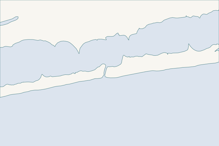
Little Lagoon Pass & the Callaway Bridge at a glance
- Who permits it
- City building permit, after Corps and State Lands approval
- Call first
- City of Gulf Shores Building Department, (251) 968-1150
- The water
- Little Lagoon, fed through the pass, which had a 1.5-foot controlling depth in 1985
- Local rule to know
- ALDOT must dredge back to -5.0 ft NAVD once the pass shoals to -3.0 ft
Get to know your waterfront
Little Lagoon Pass runs under the Lee Callaway Bridge on West Beach Boulevard (Highway 182), about three miles west of Highway 59. ALDOT owns the bridge, its seawalls and the dredging duty. The city owns Little Lagoon Pass Park beside the pass. Both sit inside Gulf Shores, so the city building office handles permits for private lots nearby.
Little Lagoon Pass Park · Gulf Frontal Watershed Management Plan, Section 4.4.2 Little Lagoon Pass · Gulf Frontal Watershed Management Plan, Section 4.4.2 · TIGERweb Places, County Subdivisions, Consolidated Cities (layer 4)
What the pass, the bridge and the dredging mean for a wall
Who owns what at the pass?
The state owns the bridge, its seawalls and the job of keeping the pass open. The city owns the park. Everything else is private lagoon-front land.
- ALDOT: the Lee Callaway Bridge on State Route 182, the seawalls at the bridge and the dredging duty. It began replacing the 1969 bridge in 2013 because of storm damage and deteriorated seawalls. Gulf Frontal plan, bridge rebuild
- City of Gulf Shores: Little Lagoon Pass Park, plus zoning and building permits for private lots. City park page
- Private owners: lagoon-front bulkheads and docks away from the bridge, under the city, State Lands, ADEM and Corps path below. City permit handbook
If your lot touches the bridge approach, ask the city whether the strip beside the road is state right-of-way. Do not assume the property line follows the old fence.
Why does ALDOT have to dredge the pass?
A court order says so. The pass once drifted east and west over three to four miles, and the 1969 bridge fixed its crossing in place. Gulf Frontal plan, court order
ALDOT put sheet-pile jetties in the pass in the early 1980s. West Beach owners sued in the early 1990s, and the jetties came out. Gulf Frontal plan, court order
The order dates to 1992. ALDOT must return the cross-section to -5.0 feet NAVD (the federal survey datum) once the pass shoals to -3.0 feet NAVD. Gulf Frontal plan, court order Dredging Today, Feb 2022
What have the dredging campaigns cost?
The latest low bid was $1,492,001 for about 58,000 cubic yards, or about $26 per cubic yard all in.
| Year | What happened | Figure |
|---|---|---|
2016 | Track hoe and trucks after the dredge barge failed | No cost in the record |
2022 | Nearly 50,000 cubic yards announced | About $1 million, or about $20 a yard |
2023 | June 30 letting, 730 contract days | Bracket $1,641,226 to $2,005,942 |
2025 | June 27 letting, 58,000 cubic yards | Low bid $1,492,001 |
2025 | Second bid, McElhenney Construction | About $1.8 million |
Sources: Gulf Coast Media, Feb 2016 Dredging Today, Feb 2022 ALDOT June 2023 letting ALDOT June 2025 letting [14]
ALDOT's own 2025 estimate range (the bracket) was $1,187,525 to $1,451,419 for 10,000 yards hauled by truck plus 48,000 pumped, or roughly $20 to $25 a yard. The low bid landed above the range, and the second bid sat about $326,000 higher. ALDOT June 2025 letting
Mechanical work also happened in November 2015, after heavy weather over two weekends pushed sand into the pass and cut into the shoreline. Dredging Wire, Nov 2015
How does the pass change lagoon water and wall loads?
The pass is the lagoon's link to the Gulf. Its brackish water mixes Lake Shelby overflow with Gulf water that enters here. USFWS funding notice NSF project summary
It is not a boat channel. In 1985 the Coast Pilot logged a controlling depth of 1.5 feet, a partly collapsed east jetty and a pipeline crossing with 7.5 feet of clearance. Coast Pilot 5
- Shoaled pass: sand builds toward the -3.0 foot trigger. Less water moves in and out, and storm-driven sand can reach the shoreline, as in 2015.
- Freshly dredged pass: the section is back near -5.0 feet. Sand goes by truck or pump to the beach west of the pass, where the shoreline can see minor effects for weeks. Dredging Today, Feb 2022
- Hard numbers: the research found no published lagoon gauge records for either state. Treat any promise of an exact water height as unproven.
For a wall, do not set cap and deck heights from today's waterline. Have a licensed surveyor tie them to mean high water (the average high-tide line) and a published datum, then let an engineer size the wall. Sea Grant permit checklist
What are Little Lagoon Pass Park and the Lagoon Pass Overlay?
The park sits directly on the pass. It has public parking, restrooms and showers on the north side, and the beach is across the road. City park page
The city accepted a design proposal in 2016 for a park pier and walkway. The estimated cost was $120,000, with a $50,000 ACAMP grant. City Resolution 5740-16
The Lagoon Pass Overlay is a zoning layer along undeveloped public right-of-way on the lagoon. Abutting owners may earn extra density and height by giving back public benefits. Examples are parking, a public pier, showers, shoreline improvements or below-grade bike and walking crossings at the bridge. Every deal goes through site plan review. Zoning Ordinance Sec. 10-4
A lagoon-front owner is not the one paying for dredging. The owner pays for survey, design and permits, and for a wall that still works when the pass is full of sand.
What should a lagoon-side owner check first?
- Confirm the lot is inside the city, and whether any strip beside Highway 182 is ALDOT land.
- Ask the Building Department for a floodplain development permit check. Any change to land in a mapped flood area needs one. City flood code
- Compare repair and replacement in the repair or replace guide, then book a seawall assessment.
- Read flood zones and elevation before choosing a cap height, and the storm history for what past surges did to walls.
Neighbors on this water are the north shore and Mo's Landing, the south shore and west end and West Beach, where the dredged sand ends up. Gulf-front work follows the Gulf-front armoring guide. For the lagoon's eastern end, see Stanton Creek and the old-town canals.
What could the work cost?
Cost ranges here are national, not local. Angi lists $200 to $600 per foot for vinyl and $250 to $700 for steel, so 80 feet of vinyl runs about $16,000 to $48,000 before permits. The Corps charges $10 for a personal-use individual permit and nothing for a nationwide permit. Ask every bid to list footage, cap, tiebacks and permit costs on separate lines.
These are published prices, not a quote. Local numbers come from Baldwin County public bids and Orange Beach permits. National guides fill the gaps and are labeled as national. Your wall depends on height, access, soil and permits.
Compare quotes and plan a budget →Find the relevant permits and records
| Starting point | What to resolve | Prepare and look up |
|---|---|---|
City of Gulf Shores Building Department | City permit to build a bulkhead, retaining wall, dock or boathouse | Call (251) 968-1150. The bulkhead permit costs $50, plus a $25 application charge. Corps and State Lands approval comes first. |
City floodplain administrator | Floodplain development permit for any change in a mapped flood area | The chief building official holds this role. Bring plans showing elevations, location and size of the work. |
U.S. Army Corps of Engineers, Mobile District | Federal permit for work in or at the water | Call (251) 690-2658 and apply through the Corps online portal. Nationwide Permit 13 covers many bulkheads up to 500 feet. |
Alabama State Lands Division, Coastal Section | Consent for structures on state submerged land | Call (251) 621-1216. In tidal waters, a replacement may be built along the old wall line, or two feet farther out at most. |
ADEM Coastal Program | Coastal area permit for shoreline armoring | Call (251) 304-1176. Show the wall stands on or above the high-tide line and that no natural option will work. Fees run $800 to $1,665. |
ALDOT | Bridge, bridge seawalls and pass dredging | Do not alter the bridge walls. Watch ALDOT letting lists for the next dredging item before you schedule heavy work nearby. |
How to find out what is already on record for your lot
Five lookups that cost nothing and shape the project.
Ask the city for your elevation certificate
Elevation certificates are on file at the city for buildings put up since 1998. Ask the permit technician at the Building Department.
Check your flood zone
Request a flood zone determination from the Building Department or read the FEMA map yourself. Note the base flood elevation.
Search ADEM eFile for nearby permits
Filter by Baldwin County and Permitting documents. Retrieved files may be incomplete, and a search is not a formal records request.
Order a survey tied to mean high water
A licensed Alabama surveyor can mark mean high water and elevations. State Lands and the Corps both expect that survey in a living shoreline or wall package.
Living Shorelines: A Permitting Guide for Alabama Homeowners (Publication 3120, MASGC-17-068)
Watch the ALDOT dredging cycle
Dredging items appear on ALDOT letting lists, as the June 2023 and June 2025 items did. Plan noisy or sand-sensitive work around them.
Proposal Letting List June 30, 2023, Transportation Letting · Proposal Letting List June 27, 2025, Transportation Letting
Planning a wall near Little Lagoon Pass?
Send the address and a few photos of the wall and shoreline. A local marine contractor can call back once the lot, elevation and permit route are sorted out.
Built on Gulf Shores and Baldwin County permit rules, Alabama coastal law, public bids and storm records.
Little Lagoon Pass & the Callaway Bridge project questions
Who keeps Little Lagoon Pass open?
ALDOT does, under a court order dating to 1992. It must return the pass to -5.0 feet NAVD once sand shoals it to -3.0 feet. The city does not run the dredging.
Gulf Frontal Watershed Management Plan, Section 4.4.2 Little Lagoon Pass · Little Lagoon Pass dredging kicks off
How much did the 2025 pass dredging bid come in at?
The apparent low bid was $1,492,001 from M D Thomas Construction. The second bid was about $1.8 million. Over 58,000 cubic yards, the low bid averages about $26 per cubic yard.
[14] · Proposal Letting List June 27, 2025, Transportation Letting
Where does the dredged sand go?
In 2016 crews hauled it about 1,500 feet west of the pass to the water's edge. The 2022 project notice said properties within a mile to the west might see minor effects for six to eight weeks.
ALDOT has begun dredging Little Lagoon Pass by mechanical excavation · Little Lagoon Pass dredging kicks off
Can a boat use Little Lagoon Pass?
Do not count on it. The Coast Pilot logged a controlling depth of 1.5 feet in 1985, with a fixed bridge and a pipeline crossing. Check current conditions yourself before planning any boat access.
What does the Lagoon Pass Overlay do?
It lets the city trade extra density and height for public benefits such as parking, a public pier, showers and below-grade bridge crossings. It applies to owners next to undeveloped public right-of-way on the lagoon.
Zoning Ordinance for the City of Gulf Shores (September 14, 2026, as amended by Ordinance No. 2228)
Keep planning
Nearby waterfront guides
Little Lagoon north shore & Mo's Landing, West Beach Gulf front, East Beach & the public beach
Show sourcesHide sources
Price and technical sources
- Alabama Bid Network. Bid Results on Maintenance Dredging Of Little Lagoon Pass. Little Lagoon Pass, Gulf Shores, Alabama. Source reviewed 2026-11-01
- Angi. How Much Does It Cost to Build a Seawall? [2026 Data]. United States (national consumer guide). Source reviewed 2026-11-01
- Little Lagoon Pass ParkSource reviewed 2026-10-31
- Gulf Frontal Watershed Management Plan, Section 4.4.2 Little Lagoon PassSource reviewed 2026-10-31
- TIGERweb Places, County Subdivisions, Consolidated Cities (layer 4)Source reviewed 2026-11-01
- Building Department Building Permitting Procedures Handbook (2025) and Building FAQ (https://gulfshoresal.gov/m/faq?cat=21)Source reviewed 2026-11-01
- Little Lagoon Pass dredging kicks offSource reviewed 2026-11-01
- ALDOT has begun dredging Little Lagoon Pass by mechanical excavationSource reviewed 2026-11-01
- Proposal Letting List June 30, 2023, Transportation LettingSource reviewed 2026-11-01
- Proposal Letting List June 27, 2025, Transportation LettingSource reviewed 2026-11-01
- Dredging Little Lagoon Pass AgainSource reviewed 2026-11-01
- F19AS00267 NOFO Little Lagoon Living ShorelineSource reviewed 2026-11-01
- Groundwater Discharge, Benthic Coupling and Microalgal Community Structure in a Shallow Coastal Lagoon (LittleLagoonGroundwater)Source reviewed 2026-10-31
- United States Coast Pilot 5, Chapter 6 (Apalachicola Bay to Mobile Bay area; pages dated 25 Oct 2026)Source reviewed 2026-10-31
- Living Shorelines: A Permitting Guide for Alabama Homeowners (Publication 3120, MASGC-17-068)Source reviewed 2026-10-31
- Resolution No. 5740-16, Little Lagoon Pass Park Pier and WalkwaySource reviewed 2026-11-01
- Zoning Ordinance for the City of Gulf Shores (September 14, 2026, as amended by Ordinance No. 2228)Source reviewed 2026-11-01
- Art. IV Flood Damage Prevention, Secs. 7-76, 7-85, 7-99.1Source reviewed 2026-11-01
- Building Permits | Gulf Shores, ALSource reviewed 2026-11-01
- Gulf Shores Code of Ordinances Sec. 7-4 Building permit fees (Municode)Source reviewed 2026-11-01
- South Atlantic Division > Missions > Regulatory > AlabamaSource reviewed 2026-10-31
- 2026 Nationwide Permit 13, Bank Stabilization, 91 FR 768Source reviewed 2026-10-31
- 33 CFR 325.1 Applications for permits, paragraph (f) FeesSource reviewed 2026-10-31
- Contact Us (Alabama Department of Conservation and Natural Resources)Source reviewed 2026-10-31
- ADCNR Admin. Code r. 220-4-.09 Placement and Configuration of Piers and Other Improvements on State Owned Submerged LandsSource reviewed 2026-10-31
- Alabama Coastal Area Management Program (ADEM Coastal Program page)Source reviewed 2026-10-31
- ADEM Admin. Code r. 335-8-2-.06 Shoreline Stabilization and Erosion MitigationSource reviewed 2026-10-31
- ADEM Admin. Code Chapter 335-1-6 Application Fees, adopted rule effective October 15, 2026Source reviewed 2026-10-31
- FAQs: Building DepartmentSource reviewed 2026-11-01
- eFile: MainSource reviewed 2026-10-31
- APA-3 certification, ADEM Rule 335-1-6-.07 Payment of Fees (adopted December 12, 2025), Fee Schedule BSource reviewed 2026-10-31